
Under-Water Survey
Hydrographic Surveying & Methods:
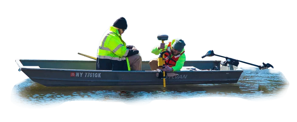
Hydrographic surveys are completed for channels, rivers, reservoirs, lakes, and ocean bays to create topographic images of underwater surfaces. Hydrographic surveys are performed to map shorelines and bed surfaces beneath a waterway or bodies of water including streams, channels, rivers, reservoirs, lakes, and ocean bays, as well as to establish water depth. Depending on the type of watercourse and the required information, a variety of techniques and watercraft are used including motorized boats, pontoons, rafts, and unmanned RCV’s. Depth soundings are integrated with GPS positions to generate a digital terrain model (DTM) and contours of the bed and shore. Deliverables include DTM surfaces, thalweg profiles (deepest part of the channel), cross-sections, and water volumes. Control Point Associates, Inc. owns and operates several types of equipment specific to hydrographic surveying including boats and high-frequency depth sounders coupled with dual-frequency GPS receivers. Control Point Associates, Inc. has expertise in providing hydrographic survey services for a variety of project types including environmental, transportation, and industrial applications. Projects have been completed for bridge design, outfall scour hole mapping, environmental impact assessments, water intake design, reservoir volumes, and road and canal design.
- Underwater Topographic Surveys
- Surveys extending from the land to water
- Penetration through soft sediment to detect hard bottom elevation
- Check scour around bridges, piers, docks, bulkheads, and seawalls
- Hydrographic Cross Sections
- Mapping for waterfront developers, quarries, reservoirs, rivers, ponds, and lakes
- Pre and Post demolition/construction Hydrographic Surveys
Continue exploring
Our capabilities
3D Laser Scanning
Most 3D laser scanning projects have a shorter field schedule than traditional methods. The scanning can take a few hours to a few days, depending on the size of the site, compared to…
Explore
Our capabilities
Aerial Photogrammetry
The use of aerial photography and remote sensing technologies, coupled with ground control, produce topographic maps and orthophotographs detailing current conditions of a given area.…
Explore
Our capabilities
Construction Stakeout
Control Point Associates, Inc. provides building monitoring services for new construction and major renovation projects. Our survey crews can monitor movement, deformation and erosion…
Explore